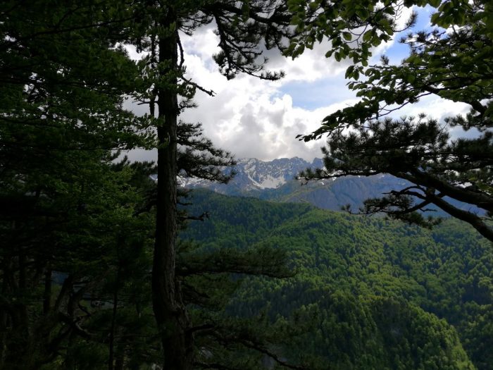
The Sutjeska National Park covers an area of 17250 hectares, more than half of which is under forest, while the rest consists of pastures, rocky terrain and mountain lakes. It is bordered to the east by the Piva mountain (1775m) and the Piva river leading to Scepan Polje, continuing along the Drina River to the mouth of the Sutjeska river. To the west lies the Zelengora massif (2014m), connected to Lelija (2032m), and to the southeast are Maglic (2386m), Volujak (2337m), and Bioc in Montenegro (2397m). The Sutjeska river and its tributaries flow through this area, with the most striking feature being the Perucica rainforest, spanning 1291ha, a unique treasure in Europe.
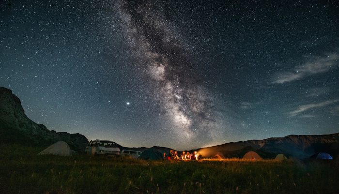
Declared a national park in 1962, Sutjeska is also renowned for its stunning glacial mountain lakes, often referred to as the “mountain eyes” due to their beauty and attractiveness, making them a key tourist attraction. The park also disposes of a hunting ground of 53240ha.
This remarkable region is abundant not only with natural beauty but also in cultural and historical heritage, offering a glimpse into the area’s past lifestyles and traditions. Among its treasures are 700-year-old medieval tombstones known as Stecak, whose engraved symbols tell unique stories of their own. The local population traditionally engaged in livestock farming, as evidenced by the summer shepherd settlements known as katuns. Even today, herders in the region follow this centuries-old tradition of grazing livestock during the summer months.
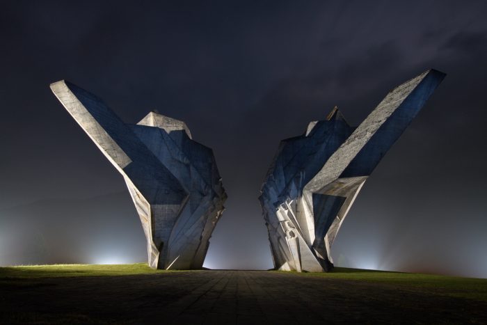
When it comes to landmarks from the more recent history, there is the memorial from World War II, commemorating the Battle of Sutjeska. This memorial, located in the Tjentiste memorial complex tells the story of the suffering and resilience of the local people. Visitors can also explore the memorial room dedicated to the 1943 Battle of Sutjeska, whose interior is decorated with wall frescoes.
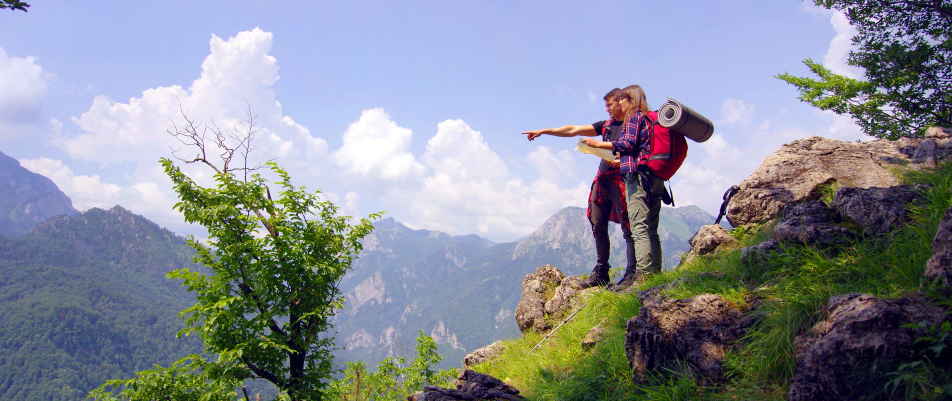
Viewpoints
Dragos Sedlo
From Tjentiste to Drago Sedlo a fairly decent macadam road stretches for 10 kilometers. At the parking lot on Dragos Sedlo about a hundred meters long trail leads to a viewpoint. Below this viewpoint lies a breathtakingly beautiful, deep forested hollow, almost completely inaccessible. At its heart, the Skakavac waterfall thunders down into the abyss from a height of over 70 meters. Across the basin rise the rocky cliffs of Volujak, with Maglic, Bosnia and Herzegovina’s highest peak, towering to the left. To the right, beyond the Sutjeska Canyon, the peaks of Zelengora are visible. The view is unforgettable! The panorama from the Dragos Sedlo viewpoint of Perucica and the Skakavac waterfall fills one with awe and satisfaction. This small fragment of pristine nature, rich in multifunctional biodiversity, has been preserved for current and future generations. The altitude of the Dragos Sedlo viewpoint is 1306 meters.
Beskita
On the road from Tjentiste to Dragos Sedlo, a few hundred meters before the parking area at Dragos Sedlo, a hiking trail begins, leading to the Beskita viewpoint. It takes about 20 minutes to walk from the main road to Beskita. The viewpoint, consisting of two platforms connected by a path, offers a stunning view of Perucica and the Valley of Heroes – Tjentiste. Beskita is located at an altitude of 1275 meters.
Prijevor
Located about 13km from the main road, the route splits, with one path leading left toward Vucevo and then to right, plunging into dense forest before opening onto a plateau beneath the peak of Maglic. Above you is Maglic, while the series of peaks stretch in fron of you – from Trnovski Durmitor, Studenac and Badanj on Volujak to the distant heights of Zelengora. During the summer, visitors can stop at the shepherd’s huts on Prijevor to enjoy homemade mountain cheese and kajmak with traditional bread baked under the bell. The Prijevor viewpoint is at an altitude of 1668 meters.
Boric
A pleasant 400-meter trail from the Lower Bare lake leads to the edge of the Sutjeska canyon, arriving at the Boric viewpoint at 1680 meters above sea level. The viewpoint, situated between Siljevica and Planinica peaks stands out due to its dominating position overlooking the steep drop into the Sutjeska Canyon. From here, one can see the entire canyon, as well as the mountains of Vucevo, Maglic and Volujak, the Perucica rainforest, Dragos Sedlo, Prijevor, the Tjentiste Valley, the ruins of old towns Vratac and Vratar and Kosman. The Boric viewpoint’s elevation is 1475 meters.
Gradac
Near Foca lies the Gradac site, also known as Gradacka Stijena, where a former fortress once stood with a military and observational purpose. This viewpoint is located on the left bank of the Drina river, overlooking the urban area of the town. The shortest route to Gradac begins on the left bank near the bridge by the Municipal building. A trail there takes about 45 minutes to climb. From this vantage point there is a stunning view of the Drina valley stretching for about ten kilometers, the Cehotina river for four to five kilometers upstream, and the peaks of surrounding mountains such as Maglic, Zelengora, Treskavica and Ljubisnja. The panorama of the town is particularly beautiful, including the confluence of the Cehotina and Drina rivers. The altitude of Gradacka Stijena is 889 meters.
Zlatni Bor
In the direction of Pljevlja at the 25th kilometer, lies the village of Zavait. From Zavait, a road branches off to the right for about 10 kilometers, leading to Zlatni Bor at the very edge of the Tara river canyon. From here, the canyons of the Piva and Tara rivers, as well as the confluence that forms the Drina are visible as if on the palm of your hand. The medieval town of Soko with its monastery, the residence of Herzog Stjepan can also be seen. On clear days, peaks of Bjelasica, Komovi, Maganik, Durmitor, Ljubisnja, Maglis, Volujak, Zelengora, Treskavica, Igman, Bjelasnica and Romanija mountains can be seen. The altitude of this viewpoint, also known as Strmena Stijena, is 989 meters. Nearby is another challenging peak called Kuk, reaching 1110 meters, suitable only for experienced climbers.
Dulin Brijeg
On the route from Foca towards Celebic and Pljevlja, at the 35th kilometer in the village of Borje, a road junction appears. The left road leads to Celebic and further to Rijeka and Pljevlja, while the right road heads towards Mestrevac. About 10 kilometers further on a hill near a hamlet, the road splits again: the left path leads to Upper Mestrevac, and the right path leads to Vranovina. After 2.5 kilometers, this road opens onto the plateau of the Tara Canyon near the village of Dulin Brijeg. This plateau features numerous viewpoints, the highest being at an altitude of 1384 meters, from which the canyons of the Susica, Tara and Piva rivers are visible, as well as the opposite side of the canyon in Montenegro. The panorama encircles mountains such as Durmitor, Bioc, Maglic, Volujak, Zelengora, Treskavica and the Piva Mountains with their surrounding plateaus. The average altitude of this plateau is 1384 meters, offering some of the most stunning photographs of the Tara canyon.
Vranovina
Upstream from Dulin Brijeg, about three kilometers across the canyon plateau, lies the village of Vranovina. This settlement is situated at the very border between the Republic of Srpska and Montenegro. The plateau’s altitude ranges from 1340 to 1550 meters above sea level, while the Tara canyon’s depth at this location is 882 meters. Only 150 meters downstream is one of the most stunning viewpoints, offering breathtaking vistas of the Tara, Piva and Susica canyons, as well as the surrounding mountain ranges Komovi, Durmitor, Maglic, Volujak, Vucevica, Bioc, Zelengora and Treskavica.
Katuns
Mountain shepherding in the area of Sutjeska National Park has been practiced since ancient times by the Illyrians, Vlachs and Slavs. Driving livestock to mountain pastures and spending summer months in katuns (seasonal shepherd settlements) is a centuries-old tradition that continues to this day.
Within the park, several katuns are still active, particularly on Zelengora and at Prijevor, located below the peak of Maglic. Here, visitors can encounter some of the oldest elements of material and spiritual culture preserved through the centuries. At Prijevor, three structures have been built in the style of authentic katuns, using stone and wood. Their interiors, however, are adapted to modern standards and designed to meet the needs of tourists.
web: NP Sutjeska
Интересантно
Area
Flora and Fauna
Festivals
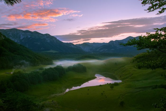
Lakes of Zelengora – “Mountain Eyes”
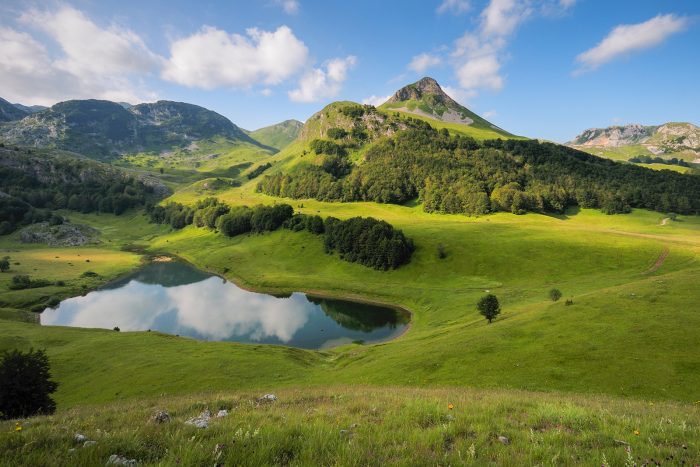
Water is the source of life, enriching nature and completing its pristine beauty. Zelengora’s unique charm lies in its “mountain eyes” – crystal-clear glacial lakes nestled at the foot of its peaks. These lakes, scattered like jewels, are a paradise for true nature lovers. Their natural surroundings, untouched by modernity, frame the pure waters in breathtaking landscapes. Such mesmerizing scenes – lakes crowned by majestic mountains and untamed wilderness – are rare treasures in today’s world.
Orlovacko lake
Orlovacko lake sits at an altitude of 1500 meters, surrounded by the peaks of Ljeljen (1765m), Orlovac (1965m) and Stog (1821m). With dimensions of 250 meters in length, 120 meters in width, and a depth of up to 4 meters, the lake is home to brown trout, lake charr and rainbow trout.
Donje Bare lake
Donje Bare lake, located at the northeastern base of Trnovica, under Planinica peak (1722m), is surrounded by meadows and smaller water bodies rich in marsh flora. At 1500 meters above sea level, it spans 200 meters in length and 140 meters in width, with a maximum depth of 4 meters.
Gornje Bare lake
Gornje Bare lake rests on the eastern slopes of Ugljesa’s peak (1858m), at an altitude of 1550 meters. Its partially marsh-covered surface offers a striking contrast against the surrounding mountain terrain.
Crno (Black) lake
Crno lake (Black lake) lies in a sandstone basin on the northwestern slopes of Zelengora, near Vrbnicke Kolibe (1622m). Its elliptical shape stretches 80 meters, with depths ranging from 1 to 1.5 meters. The lake is characterized by its dark humus-covered shores and bottom, hence its name.
Bijelo (White) lake
Bijelo lake (White Lake), positioned at 1417 meters, is encircled by Orlovaca Mountain (1960m) and Trebova. With a circular shape of about 400 meters in diameter and a depth of 4 meters, the lake’s white sandy and rocky bed contrasts with its clear waters.
Stirinsko lake
Stirinsko lake, the largest on Zelengora, lies at 1677 meters. Measuring 600 meters in length and 350 meters in width, with a depth of 2.5 meters, it features gently sloping banks and aquatic flora that hosts wild ducks.
Kotlanica lake
Kotlanica lake, located 4 kilometers south of Stirinsko, is pear-shaped and measures 300 meters in length and 80-120 meters in width, with a depth of up to 7 meters. Its emerald-green waters stem from the rich plant life beneath the surface.
Borilovacko lake
Borilovacko lake, also known as Jugovo lake, is Zelengora’s only artificial lake, set at 1450 meters and surrounded by Kalelija and Stog peaks. Spanning 250 meters in length and 100 meters in width, it is annually stocked with rainbow trout.
Kladopoljsko lake
Kladopoljsko Lake, nestled in the canyon of Kladovo Polje is encircled by Muravska Strana (1602m) and Planinica (1583m). It is fed by numerous streams throughout the year, and its waters form a small creek. The lake’s name, derived from the numerous logs (klade) resting at its bottom, adds an element of mystery, as there are no forests in the vicinity.