Welcome to Kalinovik
The Municipality of Kalinovik is located in the southeastern part of Bosnia and Herzegovina. It borders the municipalities of Foca to the east, Trnovo and Ustikolina to the north, Konjic to the west and Nevesinje and Gacko to the south.
During the medieval period, Kalinovik was first mentioned around 1323 as part of counties Viseva and Zagorje, which were ruled by Stefan Vukcic Kosaca, also known as Herzog Stefan.
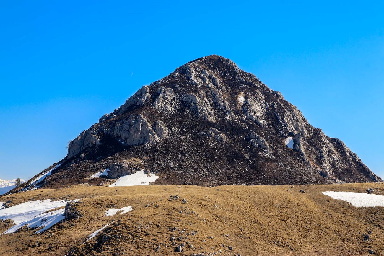
For the most of its part, the municipality spans over the Zagorje plateau, bordered by the mountain ranges of Treskavica (2088m), Lelija (2032m), Zelengora (2014m) and Crvanj (1920m). High mountainous terrain is dominating and covers over 80% of the area. The valleys of the upper streams of Neretva river to the south and Bistrica river to the northeast, along with the region’s terrain and hydrography are what defines the area.
Culture
The municipality of Kalinovik has had a stormy history, beginning with Roman settlements and continuing through Illyrian and Slavic invasions, as this area held high military-strategic and economic importance. This is witnessed by numerous Roman roads, medieval fortifications and towns such as Obalj, Ulog, Ljusici, Bojici and Vlaholje.
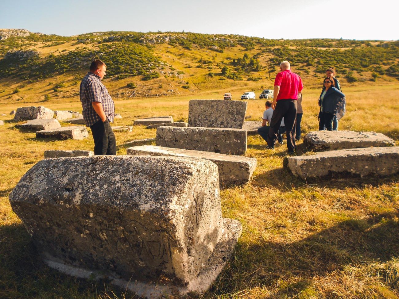
That a vibrant medieval life once existed in the area is also confirmed by the numerous Stecak tombstones of which 1793 have been discovered and documented to date. The cultural and archaeological value of these monuments is exceptional, which is why they have been included on the UNESCO World Heritage list. Among the most notable necropolises are Cengica Bara and Gvozno, which contain hundreds of Stecak tombstones in the forms of slabs, chests, clay tiles and cross-shaped monuments.
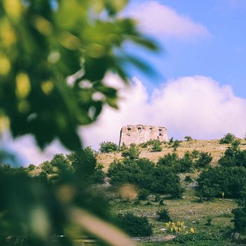
Although not yet under UNESCO protection, the fortress Gradina is an important cultural and historical heritage site of the municipality of Kalinovik. Built during Austro-Hungarian rule in the 19th century, the fortress was significantly damaged during World War II. Among the local population, there is a story that Adolf Hitler obtained his first rank as a corporal at this fortress. Movies “The Demolition Squad” (Diverzanti) and “The Battle of Sutjeska” were filmed at this location.
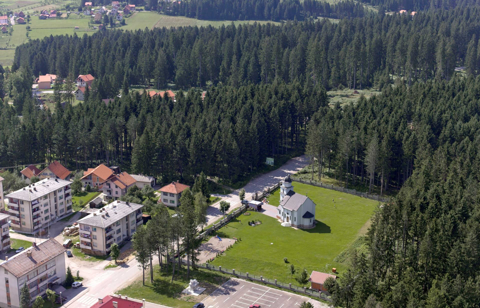
Significant cultural value is also held by numerous religious buildings in the area, The most notable are Church of St. Peter and Paul in Kalinovik, the Church of St. Basil of Ostrog in Ulog, the Holy Trinity Church in Osije, the Church of the Nativity of St. John the Baptist, the Church of St. Anne in Ulog and the Mehmed-Beg Sestokrilovic Mosque.
Nature
The municipality of Kalinovik encompasses parts of the mountain ranges of Treskavica, Visocica, Prenj, Lelija, and Zelengora along with the upper stream of Neretva river and its tributaries, as well as the Zagorje plateau, which is characterized by numerous sinkholes, karst valleys and caves. A notable curiosity is Mount Treskavica, famous for its 365 springs.
The locations of spring water, glacial lakes and permanent watercourses in the municipality is almost ideal. The Neretva River originates in this area and runs for 40 kilometers within the municipality. In addition to the Neretva, the area has 12 lakes surrounded by stunning mountain landscapes. There are also over 150 caves in the municipality territory.
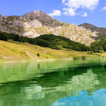
The most significant attractions are undoubtedly the mountain massifs of Zelengora and Treskavica. Zelengora is considered by many to be the most beautiful mountain in Bosnia and Herzegovina. Its glacial lakes, often referred to as the “Mountain Eyes” due to their unique beauty are a true attraction for all visitors. It is said that anyone who visits Zelengora once will always return. Vast areas of forests and pastures, abundant forest fruits, medicinal plants, and clean, unpolluted air make it a natural retreat and an oasis of peace for the modern individual. Its highest peak is Bregoc at 201m. Among the lakes in this area, lakes Orlovacko and Kladopoljsko stand out as particularly attractive to visitors.
Treskavica is a mountain of high peaks, spacious pastures and beautiful lakes. With its 365 springs, numerous lakes, picturesque pastures, karst formations and rich flora and fauna, it is a true attraction for mountaineers, tourists, and nature lovers. The highest peak Djokin Toranj reaches 2088 meters, and on clear days it offers a view extending all the way to the Adriatic Sea.
On Treskavica, above the Gvozno field in a beautiful beech forest, lies Gvozno Lake. It is surrounded by peaks such as Mali Treskac (1969m), Malo Vratlo (1950m) and Bosansko Vratlo (1780m). The lake is divided into two parts, Veliko (Large) and Malo (Small) Lake. In summer, the lake becomes rich with aquatic plants, creating a paradise habitat for wild ducks.
One part of Sutjeska National Park also extends into the Kalinovik municipality. It represents the region’s greatest natural treasure offering many attractions, features and opportunities for the development of adventure tourism.
Adventure

The rich nature of this region simply yearns for adventure.
Mountaineering, cycling, speleology… are just some of the activities you can enjoy here.
Kalinovik is located along the White line of the “Via Dinarica” project.
Gastro
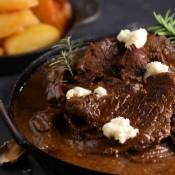
The abundance of nature and the clean air make every bite prepared by the skilled hands of these provides a special treat for the palate. The renowned “Kalinovik goulash” (stew) can be tasted during Kotlicijada (cauldron stew cooking competition), an event organized by the Kalinovik Tourism Organization.
Mountaineering and tourist lodge Jelasca is located along the Via Dinarica trail, offering organic food and accommodation in a wooden object with sanitary facilities (bathroom and WC). The accommodation consists of three separate rooms, a kitchen and a sanitation block (bathroom and separate toilets for men and women).
The lodge’s menu includes homemade food such as cheese, kajmak, milk, whey, meat, local honey and homemade bread (buckwheat, wheat and rye). The owner Mila Lalovic, also runs a farm of laying hens.
Tourist organization of Kalinovik
Via Dinarica
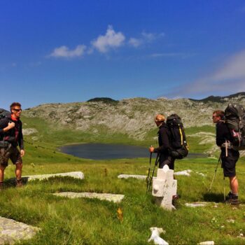
The White Trail is the main route of the “Via Dinarica” line, following a natural path that connects the highest peaks of the Dinaric Alps.
The White Trail links the highest peaks in each of the countries it passes through. While the trail offers numerous activities, such as cycling and rafting, its primary purpose is mountaineering. In Bosnia and Herzegovina, the White Line goes from Maglic, through Zelengora, Lelija, Visocica, Bjelasnica, Prenj, Cvrsnica, Vran to Kamesnica, covering 334km of marked, continuous and standardized hiking trails.
Via Dinarica trails through Kalinovik include:
Via Dinarica BH-W-11 – Through mountains Lelija and Zelengora to Sutjeska National Park
Via Dinarica BH-W-10 – From Ljuta, around Treskavica to Kalinovik
Via Dinarica Obalj-Neretva Canyon-Pridvorica trail
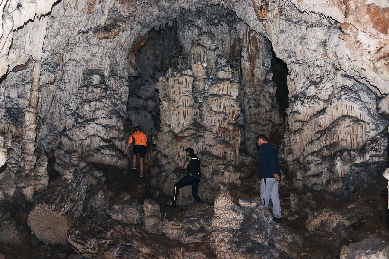
Speleology
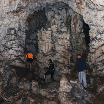
Cave Kuk – A natural site of great significance, Cave Kuk is considered one of the three most beautiful caves in Republika Srpska. It is located on the Sijerca cliffs, in the highest part of the Bistrica River canyon. The cave is protected by the Institute for the Protection of Cultural, Historical and Natural Heritage of Republika Srpska and is classified as a natural asset of Category II.
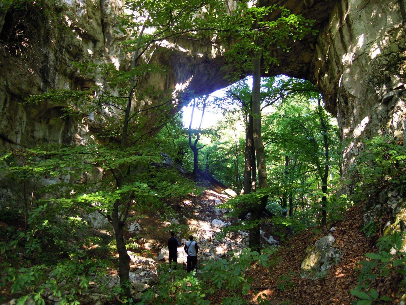
Samar Arch on the Bistrica river – River Bistrica carved a 9km long tunnel-like cave known as the Samar Arch. This is a rare geomorphological phenomenon in the world. It features a large hill with gorges through which the Bistrica flows for a stretch of 100 meters before re-emerging on the surface.
Glavicine Cave – The entrance to Glavicine cave is located in Dobre Vode, near the village of Borija close to Kalinovik. From the speleo-morphological perspective, the cave consists of several large halls decorated with various forms of “cave jewelry”, dominated by massive stalagmites and columns. There is no evidence in literature of a thorough research being conducted within the cave. The total length of the underground channels is approximately 300 meters. In the immediate vicinity of Glavicine cave are the caves Zobnjak and Rakovica, which most likely used to be morphologically connected to it. The cave’s abundant decorations attracted visitors who significantly damaged the ceiling ornaments in the entrance hall during the 1950s.
.
Gvozno
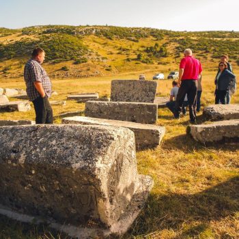
A small karst field on Treskavica mountain, located about 11km northwest of the town of Kalinovik. The field is surrounded by rugged hills to the south and east, while to the west and north mountain forests rise first gradually and then steeply. In the southern part of the field, at the foot of Gradac Hill a necropolis with Stecak tombstones is situated on slightly elevated terrain. The site is approximately 300m away from the Gradac elevation point (1396m of altitude). The Stecak tombstones quarry of the Gvozno necropolis was located a couple of dozen meters southwest of the necropolis, at the foothill of Gradac. The Gvozno necropolis takes up an area of 46 x 23 meters. The tombstones are predominantly oriented west–east, with a smaller number positioned northwest–southeast. Between the graves with tombstones, some graves marked only by stone outlines on the surface can also be observed. The necropolis contains a total of 87 tombstones: 27 slabs, 54 chests, 4 clay tiles and 2 cross-shaped monuments. Fourteen tombstones are decorated. The decorations include hunting and dancing scenes, with depictions of dogs appearing multiple times. A unique feature of the site is the representation of winged dragons.
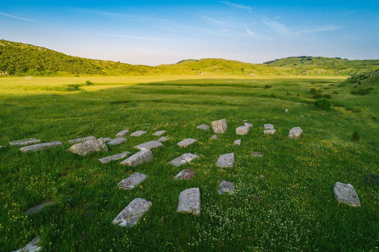
Stecak tombstones – Cengica Bara and Gvozno
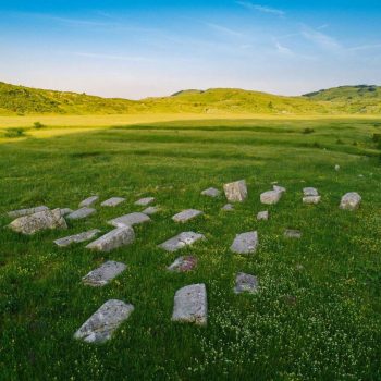
The necropolis is situated on a small hill in the middle of a karst field at an altitude of 1370 meters. It is approximately 11km southwest of Kalinovik. Stecak tombstones are placed in the east-west direction and arranged in rows. The monuments are well-carved and preserved, made from limestone. The quarry is located about 100 meters southeast of the necropolis. At the site, there are 52 tombstones, including 11 slabs, 35 chests (several of which are tall chests with bases), and 6 clay tiles Nineteen stones are decorated: 1 slab, 12 chests, and 6 clay tiles. The most common motifs include twisted cords and friezes with bent trefoils, followed by shields and swords, stylized plants, crosses in circular wreaths, birds, deer, hunting scenes with deer and depictions of wheels and tournaments. One tombstone has an inscription saying that Stojan Opodinovic lies buried there.