Welcome to Ribnik
The municipality of Ribnik is located in the northwestern part of Republic of Srpska and is one of its border regions. Ribnik, as a settlement, emerged on the left bank of the Ribnik river, which originates a few kilometers south of the settlement itself. Ribnik first gained municipal status in 1918. During the Kingdom of Yugoslavia, it was part of the Vrbas Banovina.
With the acquisition of municipal status, Ribnik began to develop and today represents a stable and economically self-sustaining community.
In terms of traffic geography, Ribnik’s territory relies on the main road (M-5) connecting Bihac and Jajce, which runs through the municipality for 17km. Another road connects Cadjavica to Banja Luka, a mountainous asphalt route approximately 50km long leading to Banja Luka.
Culture
During the medieval Bosnian state, the territory was divided into regions, each comprising several “zupas” (administrative units). The Donji Kraji region encompassed several zupas in the northwestern part of the medieval Bosnian state. One of the most significant zupas in Donji Kraji was Banjica whose territory included modern-day Ribnik Municipality and parts of the upper Sana river stream.
The population in the river valley was primarily engaged in farming, while sheep keeping activities were predominant in the hilly areas. The land in Banjica was not rich in ores or precious metals, making it uninteresting to medieval conquerors. Instead, it served as a transit area to richer regions until the Ottoman arrival in the Balkans.
The local population was predominantly Orthodox, as evidenced by numerous churches and monasteries, including the Treskavac monastery.
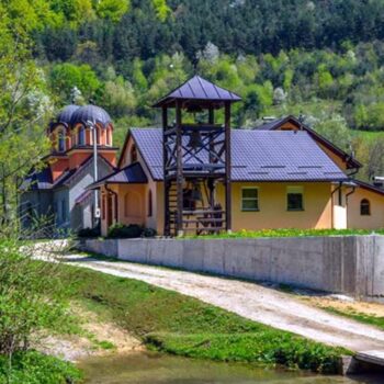
The Holy Archangel Monastery of Treskavac is a sacred place that rose from the ashes in the Bihac-Petrovac Diocese – a martyred region scarred by suffering. For years, the knowledge of this monastery was lost, and its existence forgotten. Yet, as time revealed, nothing is forgotten by the Lord, and everything unfolds at the right moment.
This sacred Krajina site faced many hardships, destroyed by some and neglected by others who wrote its history, leaving no trace of its presence. Yet, what cannot be seen by the eye exists all the same. This truth is witnessed by the revival of life at the monastery. In November 2007, episcope Hrizostom appointed hieromonk Varnava Damjanovic, a former brother of the Klisina Monastery and secretary of the Executive Council of the Bihac-Petrovac Diocese, as abbot of the Holy Archangel Monastery in Treskavac, located in the Gornji Ribnik municipality. With this appointment, hieromonk Varnava became the first monk of the Treskavac Monastery during its restoration.
Nature
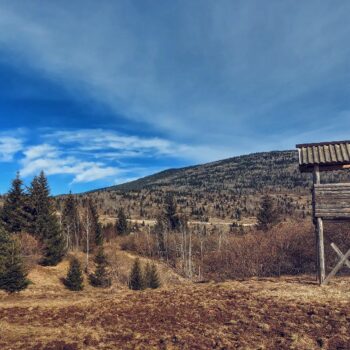
Approximately 70% of Ribnik Municipality lies in a mountainous zone, with the altitude ranging from 260 to 1480 meters. The medium-high mountains of Dimitor, Sisa, Lisina, Osoje and Manjaca dominate the area, covered in thick forests and featuring wide mountain pastures such as Crkveno, Resonovaca, Jarciste, the slopes of Dimitor and the Manjaca plateau.
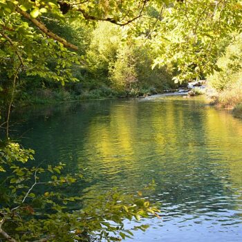
The springs of the Ribnik river are about 4km from the settlement of Ribnik, situated at an altitude of 300 meters. The river originates from several small springs that immediately merge to form a clear river flow. With a length of only about 8km, Ribnik is one of the shortest rivers. At its source, gray herons nest in a colony of over 100 pairs, building their nests high in the trees. From this safe vantage point, their young observe the passing wildlife and humans who occasionally visit, fish, or take photographs.
The Sana river is formed from three strong karst springs, whose flows converge into a single river stream. This gem in the heart of Krajina is joined along its path by numerous larger and smaller springs, creating a paradise of lush green forests and unspoiled nature.
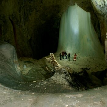
Ledana Pit is a speleological site on the southern slopes of Bobija mountain in Ribnik Municipality. It is officially the largest icy underground structure in Republic of Srpska and Bosnia and Herzegovina. Located 15km from Ribnik in the village of Vucija Poljana, it is considered a hidden treasure with unexploited tourism potential.
The pit sits at an altitude of over 1200 meters, surrounded by lush coniferous forests. Its interior, which extends 180 meters deep, remains underexplored, making it a fascinating speleological phenomenon.
The name “Ledana” (icehouse) comes from the large amounts of precipitation collected inside during winter, which freeze due to low temperatures. These ice and snow formations can persist well into the summer months.
Adventure

Ribnik offers ideal terrain for hiking and mountaineering enthusiasts. Recommended marked trails include:
- Sana Spring (5km one-way from Vrbljani)
- Ribnik Spring (10km circular trail)
- Mackica Kamen (10km circular trail)
- Okomoljak (3km)
- Prizrenac (3km from Slatina)
- Divojarac (3km)
- Prijeka Greda/Crljenica (10km)
- Kuk (3km)
- Old Village Dragoraj (5km circular trail)
These breathtaking trails will delight nature lovers, cyclists and quad lovers. For adrenaline seekers, Ribnik offers 15 climbing routes on Mackica Kamen.
Gastro
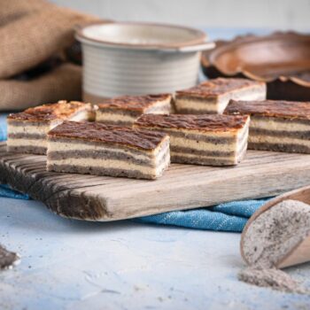
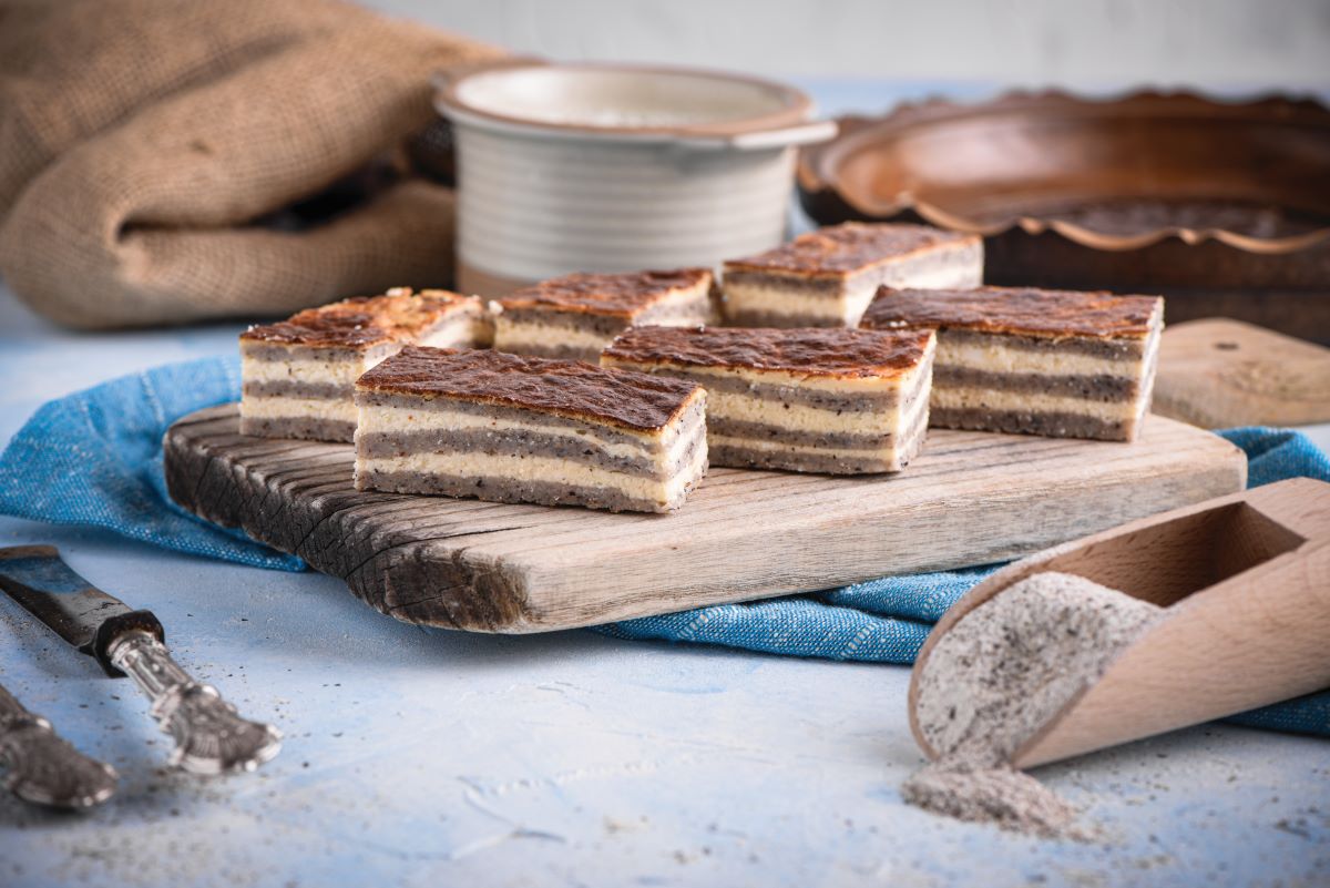
One of the culinary delights of this region, alongside grilled trout is without a doubt a buckwheat pie called Heljdina Ljevusa. This dish is made from dough combining wheat and buckwheat flour, filled with kajmak and eggs. Traditionally, it used to be prepared with nine thin layers so it was also called nine-layered pie. Today, you can enjoy a version with a single layer at local restaurants or savor the original nine-layered recipe in rural households that offer food and accommodation. Sloe berries jam, juice and liqueurs
Sloe berries (trnjina), a wild fruit with many health benefits are transformed into traditional products by the women of the Vrbljani Women’s Association. Their homemade juices, liqueurs, and jams are available for tasting or purchase in the village of Vrbljani, for those just visiting or embarking on the “Black Queen” hiking trail.
Tourist organization of Ribnik
![]()
Sources of the Sana river
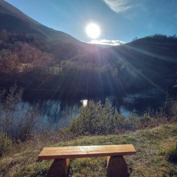
The sources of the Sana River lie in Donja Pecka (Mrkonjić Grad Municipality) and near the village of Vrbljani (Ribnik Municipality). Due to their natural and ecological value, these sources are under strict protection.
According to legend, the river’s name was given by the ancient Latins, inspired by its healing properties and purity (sano, sanare – to heal in Latin). The Sana River originates from three strong karst springs located on a plateau near Donja Pecka and Jasenovi Potoci, with a tributary called Korana. Approximately 1.5 kilometers downstream below Trbov Dol, the three springs converge into a single flow.
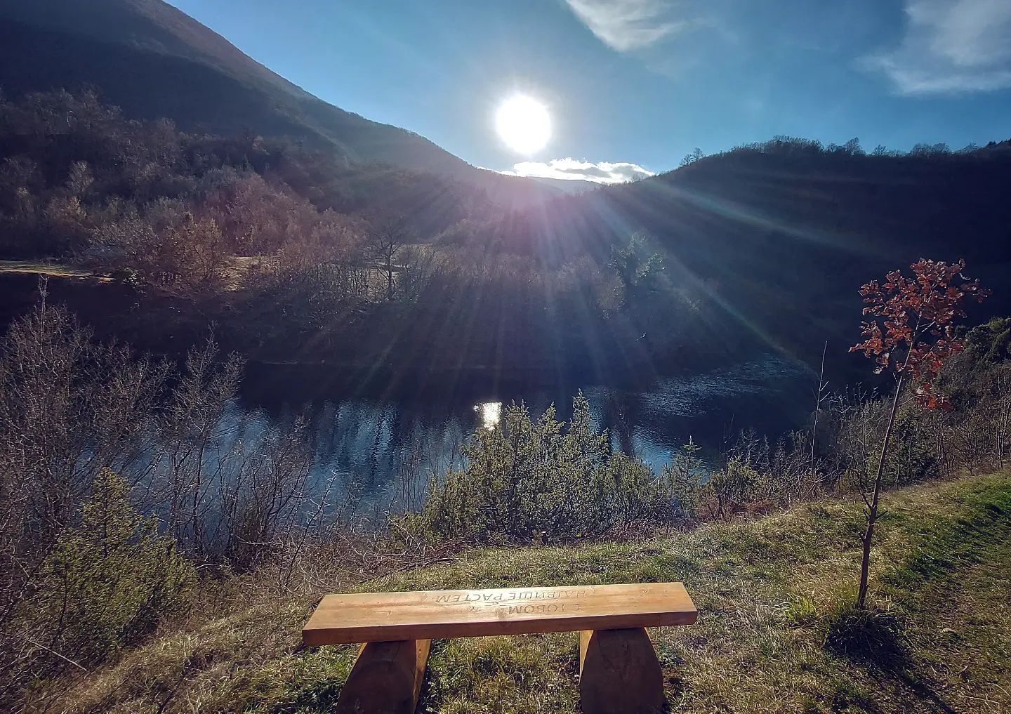
Source of the Ribnik river
The Ribnik river’s sources are about 4 kilometers from the settlement of Ribnik, situated at 300 meters above sea level. Several powerful springs merge to form a river flow, creating a short but water-rich river of approximately 8 kilometers.
The average width of the Ribnik River is about 30 meters, with a depth ranging between 50 and 80 centimeters. Its course ends at the village of Velije, where it joins the Sana river. The Ribnik River is classified as first-class water flow.
Fly fishing
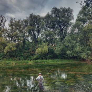 Риболов на ријеци Рибник је могућ од самог извора па све до ушћа у ријеку Сану. Риболовци из цијеле Европе посјећују ову ријеку те тако општина Рибник која је дио Динардица пројекта заједно са општинама Мркоњић Град и Шипово има изразито развијену понуду активног одмора, првенствено fly fishinga.
Туристички комплекс “ЛТГ Компану” Рибник
Туристички комплекс “Виле” Рибник посјетиоцима нуди врхунски риболов на ријекама Рибник и Сана, угодан боравак у луксузним вилама и бунгаловима као и одличну гастономску понуди.
По својој љепоти, богаству флоре и фауне, ријека Рибник уз Пливу, засигурно спада у сам врх европских топ дестинација мушичарског риболова.
Hunting
In addition to fishing, Ribnik is renowned for its hunting tourism. The “Ribnik” hunting ground, spanning 47 352 hectares, is one of the most scenic and well-maintained hunting areas in the Republic of Srpska. Diverse forested terrains intersected by Sana and Ribnik rivers, abundant mountain pastures and the clean unpolluted air provide a perfect setting for hunting and relaxation.
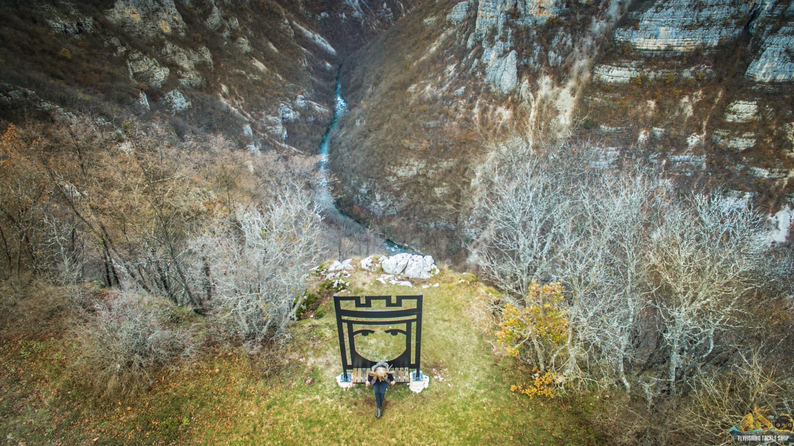
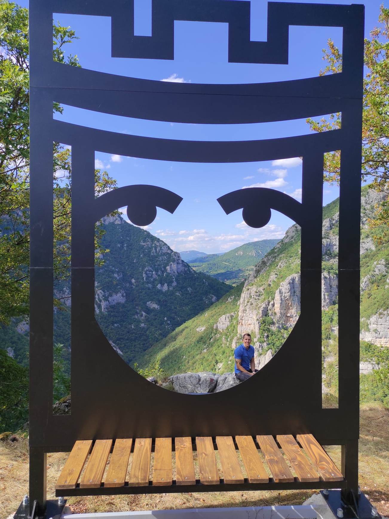
The Black Queen – thematic trail

According to legend, the last sighting of the Black Queen took place along this trail, now marked with interactive pillars where visitors can piece together the story by assembling cubes. At the Okomoljak viewpoint, a photo frame featuring the queen’s motif lets visitors to create their own postcard.
End your Black Queen journey at Vrbljani Women’s Association. These remarkable women have preserved the recipes for jams, juices and liqueurs made from blackthorn, said to have been a favored ingredient of the legendary queen. Tasting these products might even infuse you with the wisdom and strength of the Black Queen, who knows?
This product aims to revive healthy medieval traditions, reimagined as a modern tourist offering inspired by the courageous woman of these lands. Walking through unspoiled nature, picking wild herbs, enjoying photo safaris, testing your skills at archery and tasting delicacies prepared according to medieval recipes make this experience unique in the region.
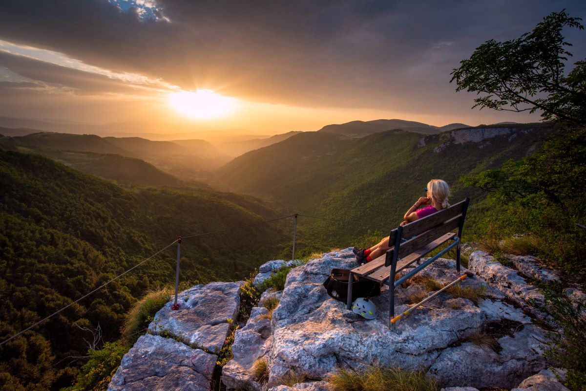
Mackica rocks
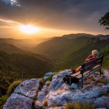
The area of Ribnik Municipality includes Mackica rocks or Mackica cliffs from which there is a view of Klekovaca, Grmec, Osjecenica, Sisa, Bobija, Zdralica, Mulez and Pljesevica. These rocks are known as the habitat of the imperial eagle (Aquila heliaca), included in the Red List of the International Union for Conservation of Nature.
Named after the village of Mackici, the rocks are 3km away from the settlement of Sitnica in the Ribnik municipality. The rocks stretch north-south over 1.5km, featuring steep, high slopes exceeding 200 meters in height. Facing the village of Mackici, they resemble defensive fortress walls. For adventure lovers, 15 sport climbing routes are arranged on these rocks.